Locations
Locations for Hiking
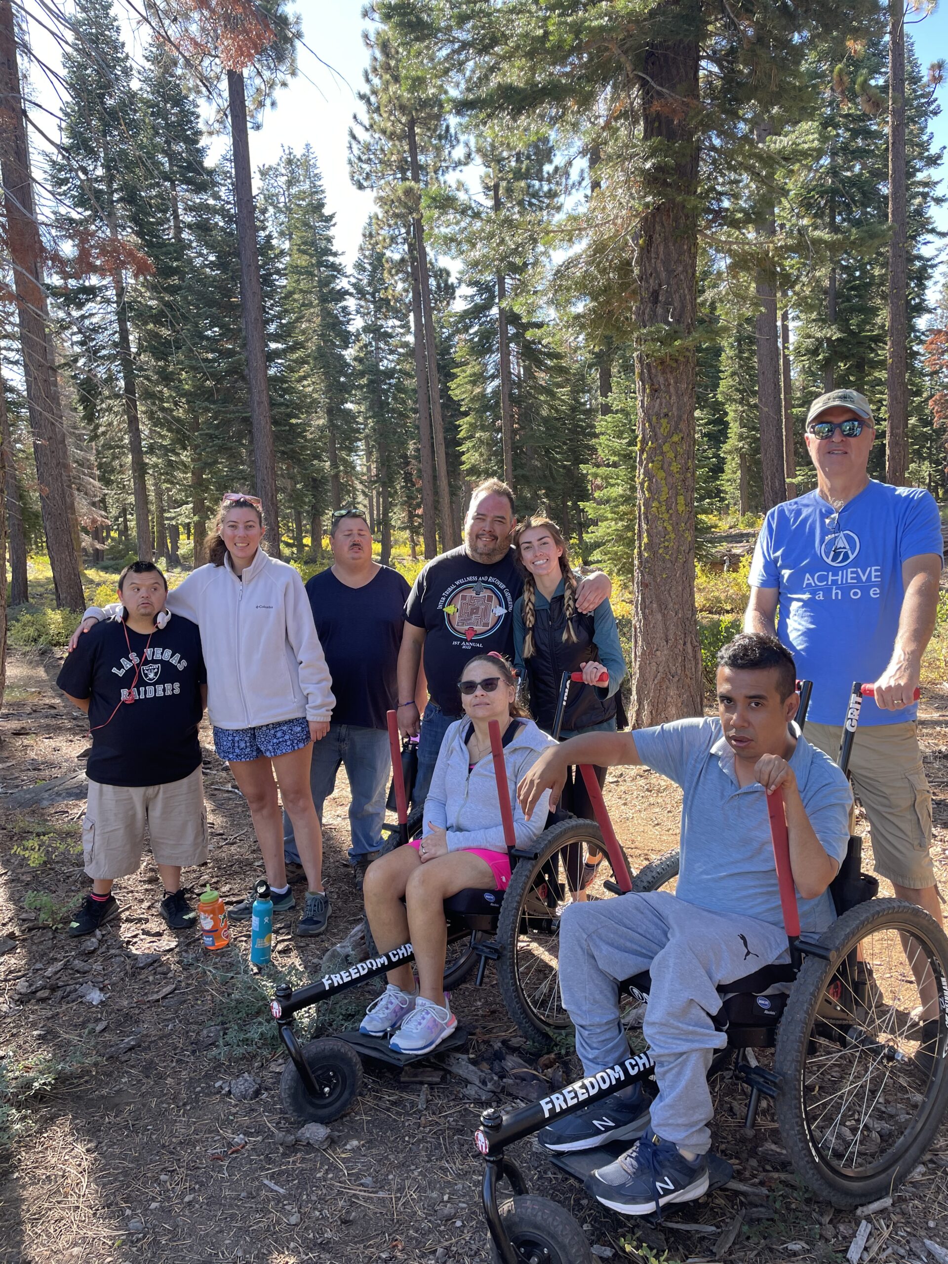
The Achieve Tahoe Hiking Program takes place on various trails throughout the North Lake Tahoe and Truckee area. Below are the 2026 trail offerings you can choose for North Lake Tahoe and Truckee Area hikes.
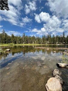
 Azalea and Flora Lake: Enjoy this hike through the forests and granite slabs of Donner Summit as we hike to two alpine lakes.
- Meeting location: Donner Summit Sno-Park (19455 Bunny Hill Dr, Soda Springs 95728)
- Trip Length: 3 miles
- Difficulty: Moderate
- Elevation gain: 217 ft
- Accessibility:
- Parking: Large, paved lot with 1 accessible van spot.
- Restrooms: Two pit toilet restrooms
- Water on site: none
- Sun exposure: 50% sun, 50% shade
- Terrain:
- Surface material: packed dirt, granite rocks, some tree roots
- Width: 1.5 – 4 feet
- Condition: maintained
- GRIT chair accessible: No
- Potential obstacles/hazards: Large tree roots and rocks in path. Some granite steps and fallen trees throughout hike. On-leash dogs are allowed on this trail.
BLACKWOOD CREEK TRAIL LOOP: Enjoy the nature of the West Shore as you find a hidden gnome village.
- MEETING LOCATION: Alongside road at the end of Grand Ave and Alpine Intersection ( Alpine Ave, Homewood, CA 96141)
- Trip Length: 2.1 - 3.1 miles
- Difficulty: easy
- Elevation gain: 173 ft
- Accessibility:
- Parking: Side of road, no marked spots
- Restrooms: none
- Water on site: none
- Sun Exposure: 80% shade, 20% sun
- Terrain:
- Surface material: packed dirt, not-packed dirt
- Width: 5 – 3 feet
- Condition: somewhat maintained
- GRIT chair accessible: no
- Potential obstacles/hazards: Trail crosses fallen trees and a marshy area in one section. Mountain bikers, hikers, and on-leash dogs share this trail.

CHINA COVE TRAIL LOOP: Come experience the beauty of Donner Lake as you hike towards China Cove.
- MEETING LOCATION: Donner Memorial Park (12849 Donner Pass Rd, Truckee, CA 96161)
- TRIP LENGTH: 3.3 miles
- DIFFICULTY: Easy
- ELEVATION GAIN: 82 ft
- ACCESSIBILITY:
- Parking: $10 parking fee unless you park along the road (paved spots with a large shoulder) unless you park along the road and walk in. Accessible parking spots available at Donner Memorial State Park.
- Restrooms: Porta Potties .2 miles into hike (2 accessible, 7 standard). More porta potties and pit toilet restrooms along the trail.
- Water on site: none
- Sun Exposure: 50% shade, 50% sun
- Terrain:
- Surface material: packed dirt, aggregate
- Width: 4 – 8 feet
- Condition: Well maintained
- GRIT chair accessible: yes
- Potential obstacles/hazards: On-leash dogs allowed on trail. Heavily used trail with some mountain bikers. A portion of this trail goes through a campground.
DOLLAR CREEK TRAIL: Experience a lovely walk through the woods with possible glimpse of Lake Tahoe.
- MEETING LOCATION: Dollar Creek Trailhead, Parking lot across from 7-11 (State Hwy 28, Tahoe City, CA 96145)
- TRIP LENGTH: 4.2 miles out and back
- DIFFICULTY: Easy
- Elevation gain: 311 ft
- Accessibility:
- Parking: small, paved parking lot with one accessible spot.
- Restrooms: one standard porta potty
- Water on site: none
- Sun Exposure: 50% shade, 50% sun
- Terrain:
- Surface material: pavement
- Width: 8 feet
- Condition: well maintained
- GRIT chair accessible: yes: easy with some moderate/steeper hills
- Potential obstacles/hazards: Trail is shared with mountain bikers, runners, and on-leash dogs.

DONNER SUMMIT CANYON: Wander through the woods for views of Donner Lake
- MEETING LOCATION: Donner Summit Canyon Trailhead (16395 Donner Pass Rd, Truckee, CA 96161)
- Trip Length: 2.6 - 3.6 miles
- Difficulty: Moderate
- Elevation gain: 279 – 557 ft
- Accessibility:
- Parking: Small, dirt parking lot with no marked spots
- Restrooms: none
- Water: none
- Sun Exposure: 75% shade, 25% sun
- Terrain:
- Surface material: packed dirt, aggregate, rocks
- Width: 2 – 6 feet
- Condition: somewhat maintained
- GRIT chair accessible: no
- Potential obstacles/hazards: large rocks and fallen trees in path. 4 steps at the bottom of the hill leading from parking lot to trail.
EAST SHORE TRAIL: Enjoy stunning views of Lake Tahoe as you hike along this paved trail.
- MEETING LOCATION: Trailhead at Tunnel Creek (1102 Tahoe Blvd, Incline Village, NV 89451)
- TRIP LENGTH: 1 - 5.2 miles
- Difficulty: easy
- Elevation gain: 144 ft
- Accessibility:
- Parking: large, paved parking lot with 4 accessible parking spots. Parking is $3-4/hour (depending on time of day). Free parking is available on the side of HWY 28 north of the paid parking area.
- Restrooms: One accessible porta potty, one standard porta potty
- Water on site: yes
- Sun Exposure: 5% shade, 95% sun
- Terrain:
- Surface material: pavement
- Width: 6 – 8 feet
- Condition: well maintained
- GRIT chair accessible: yes: moderate
- Potential obstacles/hazards: Heavily used trail for bike riders, hikers, beachgoers, and on-leash dogs. There is minimal shade on this hike. There is one steep hill at the beginning of the trail.

ELIZABETHTOWN MEADOWS TRAIL: Come enjoy the solitude of a meadow hike starting at Northstar.
- MEETING LOCATION: Northstar Castle Peak Parking lot
- Trip Length: 1 - 5 miles
- Difficulty: moderate
- Elevation gain: 410 ft
- Accessibility:
- Parking: large, paved parking lot, 1 accessible van parking spot.
- Restrooms: none (closed during summer)
- Water on site: none
- Sun Exposure: 55% shade, 45% sun
- Terrain:
- Surface material: packed dirt, aggregate, wooden bridges, large rocks
- Width: 2-3 feet
- Condition: maintained for mountain bikers
- GRIT chair accessible: no
- Potential obstacles/hazards: uneven terrain, popular mountain biking trail, dogs allowed on leash.
OLYMPIC VALLEY TRAIL: Enjoy striking views of Olympic Valley at Palisades Tahoe and the Olympic Valley meadow while walking this gentle paved path.
- MEETING LOCATION: Olympic Valley Park (101 Olympic Valley Rd, Olympic Valley, CA 96146)
- TRIP LENGTH: 1 - 4.2 miles
- DIFFICULTY: Easy
- ELEVATION GAIN: 112 ft
- ACCESSIBILITY:
- Parking: Large, paved parking lot. 4 accessible parking spots.
- Restrooms: Two accessible pit toilets.
- Water on site: Yes
- Sun Exposure: 10% shade, 90% sun
- Terrain:
- Surface material: pavement
- Width: 8 feet
- Condition: smooth until entering Palisades parking lot, which is cracked and bumpy.
- GRIT chair accessible: yes: easy
- Potential obstacles/hazards: Steep hill at beginning of hike, heavily populated trail with hikers, bike riders, and on-leash dogs. There is little shade on this hike.
RIDGELINE NATURE LOOP: Come experience views of Truckee on this accessible trail.
- MEETING LOCATION: Sawtooth Trailhead ( 11614-, 11632 06 Fire Rd, Truckee, CA 96161)
- Trip Length: 1.3 miles
- Difficulty: easy
- Elevation gain: 46 ft
- Accessibility:
- Parking: Paved and dirt parking lots. No designated accessible parking spots.
- Restrooms: Two pit toilet restrooms
- Water on site: none
- Sun Exposure: 60% shade, 40% sun
- Terrain:
- Surface material: ¾” aggregate base
- Width: 30” – 60”
- Condition: well maintained
- GRIT chair accessible: yes
- Potential obstacles/hazards: popular mountain bike trail, dogs
TAHOE CROSS COUNTRY SKI AREA: This vast network of trails offers numerous options for all abilities around scenic Dollar Creek.
- MEETING LOCATION: Tahoe Cross Country Ski Area (925 Country Club Dr, Tahoe City, CA 96145)
- TRIP LENGTH: 2 - 8 miles, depending on the group
- DIFFICULTY: Easy
- Elevation gain: 100+ ft
- Accessibility:
- Parking: small, paved parking lot with two accessible parking spots
- Restrooms: accessible restrooms
- Water on site: yes
- Sun Exposure: 20% shade, 80% sun
- Terrain:
- Surface material: packed dirt, aggregate
- Width: 2 – 8 feet
- Condition: well maintained
- GRIT chair accessible: yes: easy
- Potential obstacles/hazards: Trails are shared with mountain bikers and hikers. Single track trails may not be appropriate for those using mobility devices but dirt roads are accessible.
TAHOE DONNER TRAIL SYSTEM: Enjoy a hike through the wooded and wild terrain of the Tahoe Donner Trail System.
- MEETING LOCATION: Alder Creek Adventure Center (15275 Alder Creek Rd. Truckee, CA 96161)
- TRIP LENGTH: 2 - 6 miles
- DIFFICULTY: Easy
- Elevation gain: 416 + ft
- Accessibility:
- Parking: medium, paved parking lot with two accessible parking spots
- Restrooms: Stalled restrooms with one accessible stall available if the center is open.
- Water on site: yes
- Sun Exposure: 25% shade, 75% sun
- Terrain:
- Surface material: packed dirt
- Width: 5 – 3 feet
- Condition: well maintained
- GRIT chair accessible: On some trails: moderate
- Potential obstacles/hazards: Popular mountain biking trail, dogs allowed off-leash, steep hills in some sections.
TRUCKEE RIVER LEGACY TRAIL: This trail offers a great way to explore the Truckee River on a paved path.
- MEETING LOCATION: Riverview Sports Park (12200 Joerger Dr, Truckee, CA 96161)
- Trip Length: 1 to 9.6 miles
- Difficulty: easy
- Elevation gain: 472 ft
- Accessibility:
- Parking: Medium, paved parking lot with 3 accessible van parking spots
- Restrooms: 4 accessible restrooms
- Water on site: yes
- Sun Exposure: 25% shade, 75% sun
- Terrain:
- Surface material: pavement
- Width: 8 feet
- Condition: well maintained
- GRIT chair accessible: yes: easy
- Potential obstacles/hazards: popular trail shared by bike riders, hikers, and on-leash dogs.
Ward Creek Trail: Enjoy a hike through redwoods and pine trees on this west shore hike.
- Meeting Location: Rideout Community Center (740 Timberland Ln. Tahoe City, CA 96145)
- Trip Length: 2.8 miles
- Difficulty: Easy
- Elevation gain: 262 ft
- Accessibility:
- Parking: small, paved parking lot with 2 accessible van spots
- Restrooms: none
- Water on site: yes
- Sun Exposure: 65% shade, 35% sun
- Terrain:
- Surface material: dirt, packed dirt, some rocks
- Width: 5 – 4 feet
- Condition: maintained
- GRIT chair accessible: yes – moderate
- Potential obstacles/hazards: Trail is shared by mountain bikers, hikers, on-leash dogs. Parts of trail have rocks and steeper sections of hill.
Watson Lake Walk: Enjoy a quiet hike high above Lake Tahoe with the opportunity to feed Chickadees.
- Meeting Location: Big Chief – South Trailhead via Carnelian Bay Ave (6VH3+6PV, Cedar Flat, CA 96140)
- Trip Length: 1.5 to 2 miles
- Difficulty: easy
- Elevation gain: 180 ft
- Accessibility:
- Parking: Small, dirt lot with no marked spots or parking on side of road.
- Restrooms: none
- Water on site: none
- Sun Exposure: 50% shade, 50% sun
- Terrain:
- Surface material: dirt, large rocks
- Width: 2 feet
- Condition: maintained but rocky
- GRIT chair accessible: possible but hard
- Potential obstacles/hazards: rocky, possible fallen trees, mountain bikers, on-leash dogs, and long secluded drive to trailhead.